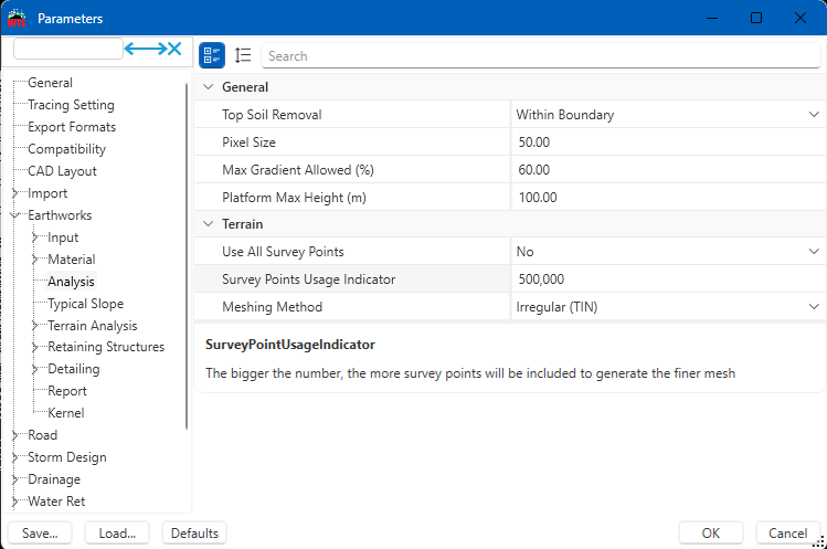
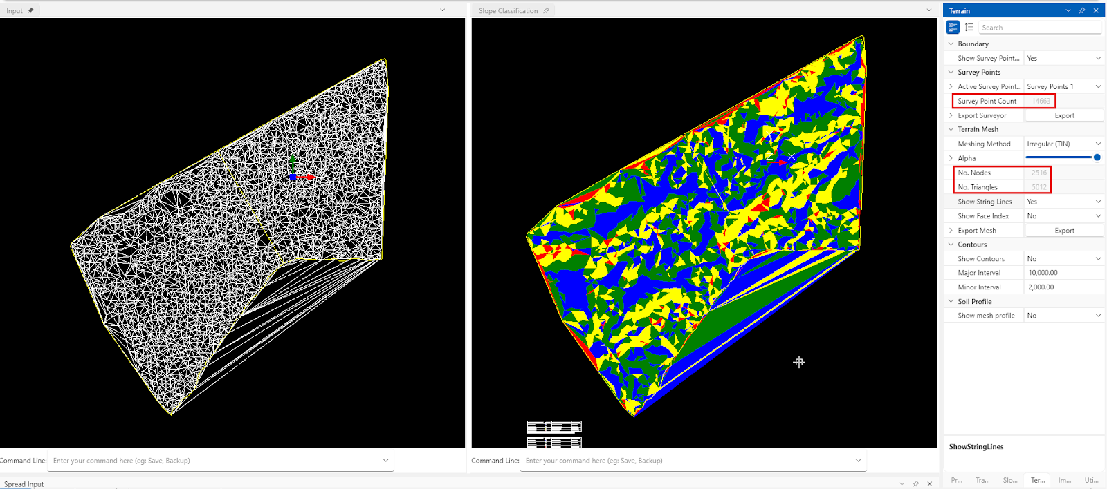
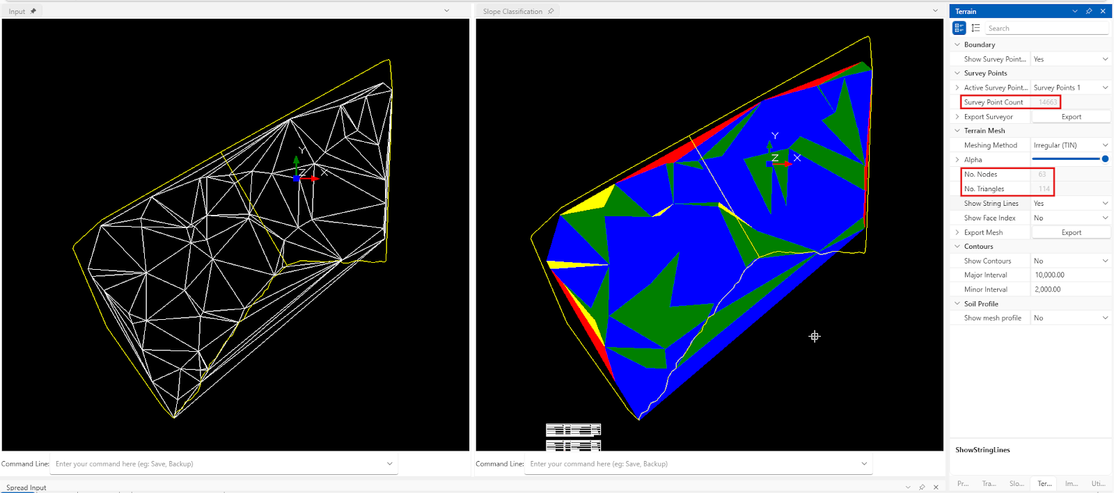
Users can control the mesh generation (triangulation) in their project file using the Survey Points Usage Indicator. This option can be found in the Options > Project Settings > Earthworks > Analysis > Use All Survey Points == No > Survey Points Usage Indicator. The bigger the number of survey points use, the finer the mesh generated (more triangulation).
This indicator is important because the high usage indicator will provide a more accurate representation of ground level conditions for cut and fill, though it will take longer to compute. Conversely, the low usage indicator will compute faster but offer less accuracy in cut and fill measurements.
The difference can also be seen in the Input screen, Slope Classification, and Terrain tab.


I’m the Benevolent Dictator for Life for MiTS Software cum Editor of this website. Read more here.
You can also contact me at soonhui@mes100.com


