There are times where users will encounter problems where the imported surveyor points are having too high or too low Z-value. These wrong surveyor points should be deleted.
How To Identify The Wrong Surveyor Points #
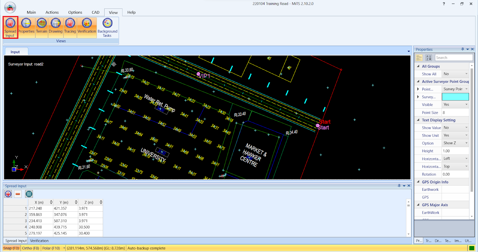
- Go to “Survey Points & Soil Info” > “Edit”

- Ensure that the “Spread Input” tab is active
- Click the table header “Z (m)” to sort the Z-value

- After sorting the “Z (m)” column, the Z-value will be arranged in ascending or descending order. By doing so, users can directly identify which point has too high or too low Z-value.

- In order to confirm that a particular point has too high or too low Z-value, users can check the Z-value of neighbouring surveyor points.
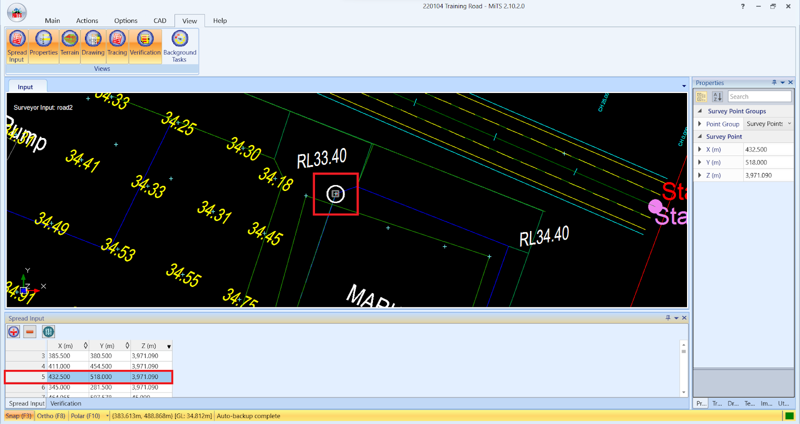
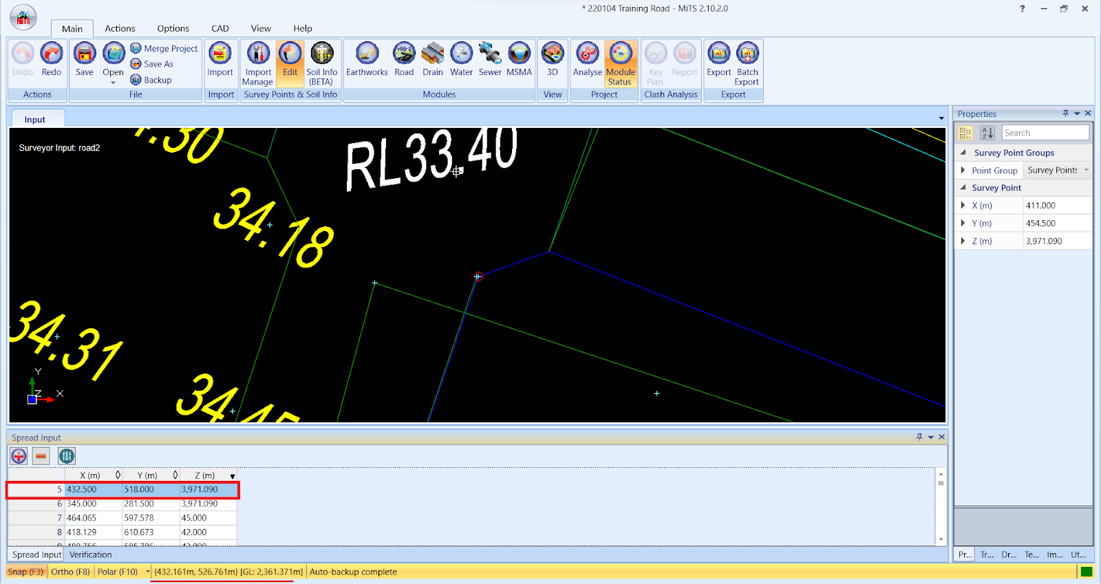
- Double click on the row which users want to check the neighbouring surveyor points, the selected points will be highlighted on the screen.
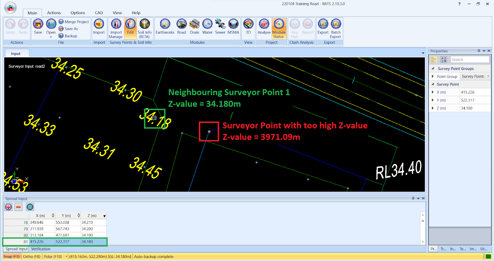
- Users can click on the neighbouring surveyor point in order to check the Z-value. As in the picture below, the surveyor point highlighted in the red box has a Z-value of 3971.09m whereas the neighbouring surveyor point highlighted in the green box has a Z-value of 34.180m.
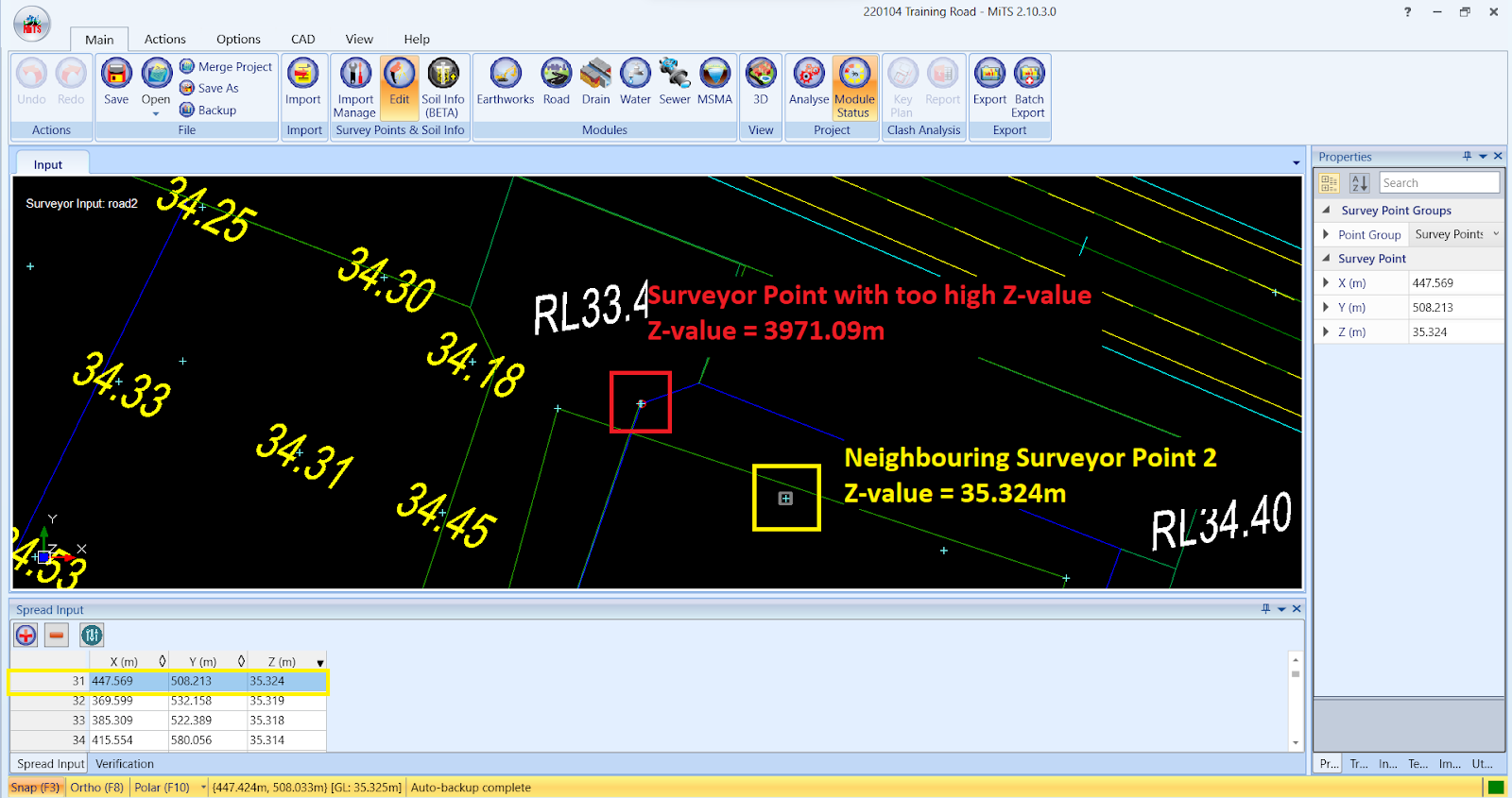
- The second neighbouring surveyor point highlighted in yellow box has a Z-value of 35.324m. Hence, this shows that the surveyor point highlighted in the red box does have too high Z-value compared to the neighbouring surveyor points.
- As for another options, users can hover the mouse cursor near the problematic surveyor point area and check the GL below the “Spread Input” tab

How To Delete The Wrong Surveyor Points #
- After identifying which survey point should be deleted, select the row in Spread Input and press delete

I’m the Benevolent Dictator for Life for MiTS Software cum Editor of this website. Read more here.
You can also contact me at soonhui@mes100.com


