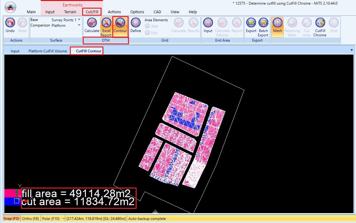
Cut and fill is a fundamental process in civil engineering and construction, where the earth is excavated (cut) from one area and relocated (filled) to another to achieve the desired site topography. In MiTS 2, we can see which area needs to be cut and which area needs to be filled after calculating the cut and fill using the DTM method.
After the cut and fill for an area have been calculated, you can click the “Contour” button in the “DTM” panel to generate the cut and fill contour of the area. As per the image below, the pink colour represents the fill area which is 49114.28 m2 while the blue colour represents the cut area which is 11834.72 m2.
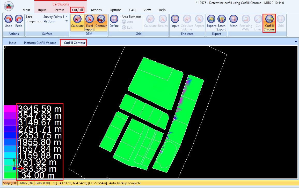
However, we do not know how much depth of the area needs to be cut or filled. Therefore, you just need to click the “CutFill Chrome” button at the last panel of the “Cut/Fill” tab. As per the image below, you can determine the depth of the cut or fill area by the gradient of the colour shown in the area. You can refer to the amount of cut or fill at the bottom left corner of the “CutFill Contour” viewport.

I’m the Benevolent Dictator for Life for MiTS Software cum Editor of this website. Read more here.
You can also contact me at soonhui@mes100.com


