We are excited to announce the arrival of MiTS 2.10 version. Discover more about the future of infrastructure software with this latest version. This release brings about 200 new features and bug fixes. Do upgrade to MiTS 2.10 and enjoy all of the latest enhancements!
So, what to expect in this latest release?
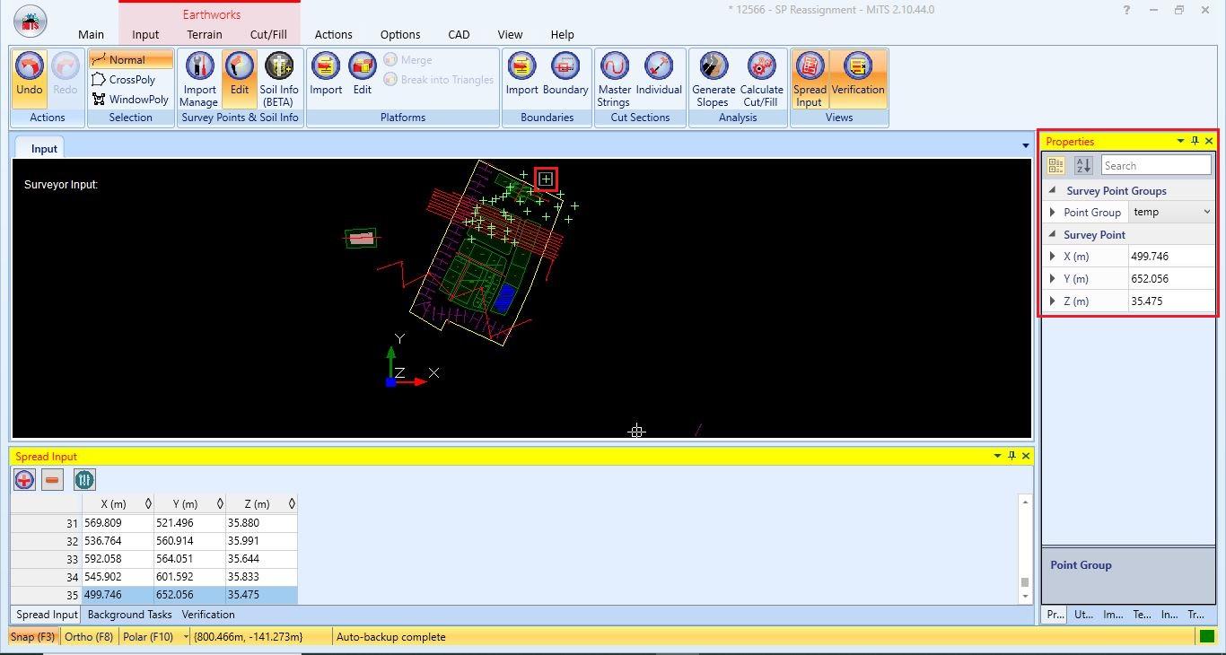
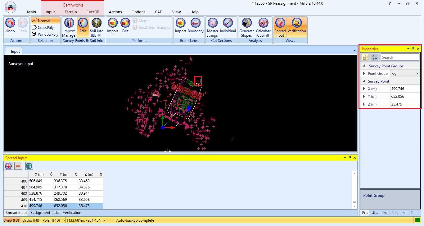
Hiding a Certain Area of Survey Points
A unique feature to only hide a few selected survey points has been added to our newest MiTS 2.10 release. This functionality to selectively conceal specific survey points offers valuable flexibility for situations where individuals wish to render certain survey points imperceptible within particular regions of their project.

| Original group of selected survey point | Assigned group of selected survey point |
 |  |
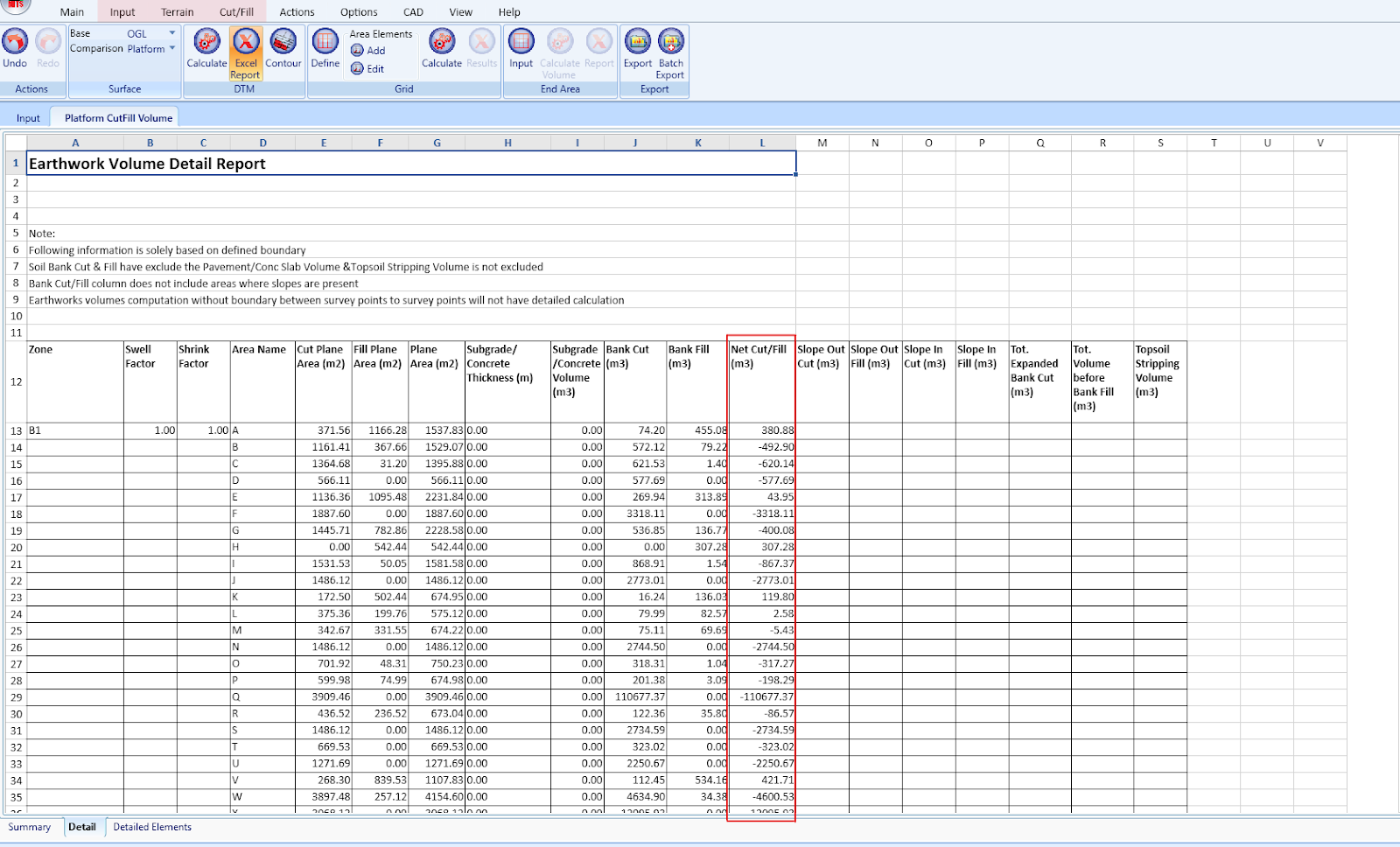
Net Cut/Fill Volume
We now implement the net cut/fill volume for each of the platforms in a detailed DTM report. This is rather useful for a project with hundreds of platforms. You do not have to manually calculate this net cut/fill volume anymore. Just design and run the software, and you will get the report effortlessly.
Self-Generate Internal Road Platform
Creating a road in MiTS 2 is typically done through the Road module, but for simple internal roads within residential areas, the process can be complex. It involves configuring various road attributes one by one, such as Horizontal, Road Width, Superelevation and Vertical.
However, a new feature in the Earthwork module called ‘Create Internal Road String’, simplifies this process by allowing the quick creation of internal roads in just a few seconds by only inserting the road elevation and its road width.
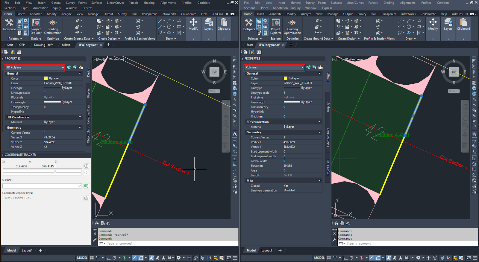
Export Retaining Wall as 2D or 3D Polyline in CAD Drawing
In the previous release, when the users export the (EW) Keyplan of a project with a retaining wall, the retaining wall is automatically set as a 3D polyline when opening the export drawing in CAD software. If you want to edit the retaining wall in CAD software, it is quite hard and complicated since this 3D polyline is really hard to edit when it comes to Z property.
Now, you can choose whether to export to 3D polyline or 2D polyline. Just adjust some settings in the project parameter and you can edit the drawing with ease of heart in the CAD software.
Utility Modules: Custom Nodes & Edges Prefixes
The Running Network/Running Pipe system feature within our utility modules has been improvised. These improvements allow for the individualized customization of prefixes for nodes or edges on a per-running network basis. This empowers users to easily and precisely assign prefixes to nodes and edges in the utility modules, ensuring that each running network can be readily distinguished based on label patterns.
The option to define these prefixes is available within the Project Parameters for each of the utility modules. The renumbering of edges and nodes will automatically take this Prefix into consideration.


MCIntegrator Plugin for Civil 3D 2024
Attention to the Civil 3D 2024 users! With the release of Civil 3D 2024, the MCIntegrator plugin for this version also has been released. You can now seamlessly employ your Civil 3D 2024 for utility modeling and synchronize it with MiTS using this MCIntegrator plugin.
As BIM integration technology continues to advance , we are committed to ensure that MCIntegrator supports every subsequent version of Civil 3D, keeping us up-to-date with the evolving trends and demands of the AEC industry.
Hmm…is that all the improvement?!
Of course not. See here for well over 200 additional features and bug fixes, we encourage you to test out the latest version and share your valuable feedback with us.
Knowledge Base and Support
Here’s the link to our Knowledge Base, housing two subsections: User Manual and Technical Documentation.
Some honorable mentions:
- Customize Mark for Nodes and Edges – Surely you want to have your own prefixes for nodes and edges in utility modules. Visit here to learn how it works!
- Include CCF Factor in Drain and MSMA Analysis – Do you need to include CCF factor in your project? Then kindly visit this blog post for further inquiry.
- Hide Survey Points – So you want to hide certain areas of survey points? Or do you want to move the survey points temporarily? Here’s a guide to do this.
- Create Internal Road – Need to design a simple internal road for a residential area? No need to face a comples procedure in the Road module here.
- Runoff Length Based on ATJ 8/86 Pindaan 2015 – This is a benchmark on the transition length, road runoff and roa runout on tangent based on Table 4.8 in ATJ 8/86 Pindaan 2015
- New Road Width Element: Fillside Verge – Wanna create fillside verge/cutside drain along the road? You’re on the right track! Follow this blog post on its basic process.
- How Cut and Fill Calculation Works in Civil 3D – This blog post provides insights into the inner workings of Civil 3D, and how MiTS is different.
- How MiTS Helps Prestasi Perintis – A case study from our user
- The Effect of Alpha Value – How does alpha value affect the earthwork computation? Wanna know more the details on this? Learn it through the linked blog post

I’m the Benevolent Dictator for Life for MiTS Software cum Editor of this website. Read more here.
You can also contact me at soonhui@mes100.com